During the last week of March’, FLAAR Mesoamerica team continued research in the National Park Yaxha-Nakum-Naranjo in Petén. This time we decided to make an expedition for the first time to explore La Laguna Perdida. This place can be seen from Google Earth with three totally round lagoons joined together that called our attention.
We hiked up and down 3 large sloping limestone hills to get there and to return to the west end of Lake Yaxha. Some slopes were steep and slippery, so there were several members of the team descending down on the ground with ropes aided by the park soldiers and IDAEH + CONAP park rangers who were kindly supporting us in this trip. Our iPhone Xs documented 10.8 kilometers round trip and 57 flights of stairs (so about 33 flights UP and 33 flights DOWN). We are not sure how an iPhone measures how far you slid down a steep hill since the dry leaves slip out from under your boots.
In the route, we found incredible plants like large-turtle-sized smilax-like vine roots. In two areas Teco and Senaida found wild vanilla orchid vinees. We also found Pseudobombax ellipticum in full bloom (a relative of Ceiba trees).
We also went past two other lagoons (Laguna Julequito, also called La Guitarra) and Laguna Lankaja.
When we arrived at La Laguna Perdida, we could see water lilies around the shore that looked beautiful. It’s a natural area that deserves to be studied to continue identifying all of the plants in this wetlands ecosystem.
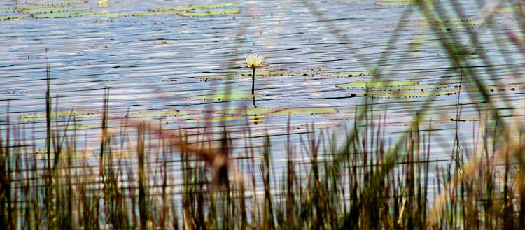
We can see a beautiful water lily on the shore of the “Laguna Perdida”.
This photo was taken at “La Laguna Perdida”, Yaxha with a Canon EOS-T6i, lens Canon EF 75-300mm; settings: f/8, speed 1/500, ISO 100. Photo by Juan Pablo Fumagalli.